Communicating with the folks back home while you’re camping seems like the last thing that you would want to do. After all, we’ve left technology behind to embrace the wilderness. There’s no better feeling than being off-grid, disconnected from the outside world. However, there are exceptions to this; you may have health problems, family that needs checking on, or you may need up-to-date information for the trip home.
While in the Pasayten wilderness, along the Canadian border (where cell coverage is just a dream), we noticed a thick smoke plume and haze started filling the basin we were camped in. The plume was to the southeast which was also the direction of our only route back to civilization. If the road were closed our weeklong trip might turn into something much longer. We needed wildfire info ASAP to make an informed decision on the safest option.
Information is power in these circumstances. Having access to reliable communications while camping in remote locations is not only a good idea, but a necessity.
I sent a message to our emergency contact at home to see if they could find any wildfire info. Within minutes we had a situation report on the fire and where it was heading (across the only road into the trailhead). With that information we were able to make a plan: break camp at first light and head for the trailhead and immediately depart for home. After receiving the fire info, I was able to share that data with some hikers camped nearby so they could make informed decisions for themselves.
Backcountry communicators are, at their best, lifesaving devices that allow you to check in with friends and family back home and reach emergency services in a pinch, even when you’re far off the grid. Here’s a breakdown of the devices we’ve used with success.
By the time we made it to the trailhead the next afternoon the smoke was getting thicker. A quickly sent off message on the SatPaq let us know that the road out was still clear, but the wind forecast had the fire line heading across it. We needed to leave ASAP. And we did!

SatPaq
So good that the US military uses them.
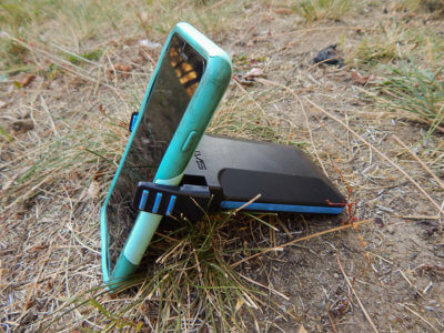
The SatPaq has become my go-to communicator because of its small size, light weight, and its ability to point to a specific satellite. It’s never failed me, and messages are sent and received fast.
The SatPaq from Higher Ground easily clips to your smartphone and connects wirelessly using Bluetooth to communicate through satellites when there is no cell coverage. SatPaq’s SpaceLinq app is free and allows you to send and receive messages, get instant weather forecasts, share your location, and get help in emergencies – all without having to pay monthly service fees.
By the time we got to the bottom of the mountain and back onto paved roads the impact of the fire was clear. The mountainsides that were green on the way in a few days before were blackened and still smoking.

Reliably rugged GPS tracking and much more.
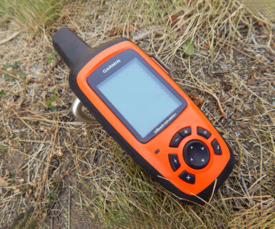
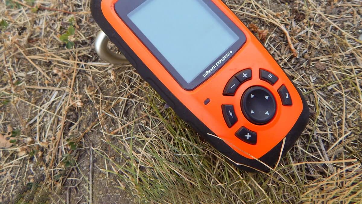
The best thing about InReach is that it’s built to take abuse. Add to that the easy-to-use operating system and you’ve got a reliable tool that doesn’t require a smartphone to operate.
Although a smartphone isn’t required, you can still pair the device to your phone for a much larger and easier to use screen with the free Earthmate app.
Essentially a GPS unit that does more, you can use the inReach to track your ride and record all of the statistics that we love such as altitude, average speed, and other similar data.
The fire line was a half-mile away from a critical intersection that we turned at. And the surrounding area was crisscrossed with red streaks from aerial fire-retardant drops.
Spot X – Self-contained communications.

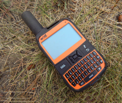
Similar to the inReach, the Spot X is its own self-contained unit, not needing to piggyback off phones via Bluetooth. It will track your route, send your location, and text updates. The Spot X also features a full keyboard and a cursor button for navigating the screen. No endless scrolling to find a letter on a display screen.
A note on those buttons: unless you have tiny fingers, they may prove too small for typing with gloves on and are hard to use in heavy rain, snow, or finger-freezing subzero winds.
We were never in immediate danger, but had the wind shifted it could have become interesting in short order. With the SatPaq we had access to the data that allowed us to make informed decisions.
Staying in communication while visiting remote parts of the world is never easy. There is seldom reliable cell phone coverage in the backcountry. But thankfully with these powerful and effective devices those who routinely find themselves in distant corners of the globe and in need of communications have several very good tools at their disposal.
Tip: Be sure to educate all involved before your trip on what to expect when tracking your progress with these devices. If they don’t know what to expect, they may alert rescue teams when they are not needed.
As always for more information on trail riding, camping with horses, and the largest guide to horse trails and camps in the world visit us at www.TrailMeister.com.
See this article in the August 2021 online edition:

Robert Eversole, ”the trail meister,” owns www.TrailMeister.com, the largest database of horse riding and camping areas in the U.S. with free trail and trailhead information, trail maps, and much more to help horse enthusiasts experience the joys of trail riding. Robert is a registered riding instructor with PATH International, a mounted search and rescue team member, and a U.S. Marine who has served on the board of the Backcountry Horsemen of Washington (BCHW). He is enjoying his new career helping fellow trail riders stay found and safe on the trail. When not on the trail, The Trail Meister resides near Spokane, WA and teaches land navigation to a wide variety of outdoor groups across the nation. For North America’s largest horse trail and camping directory, trail tips, and more, visit www.TrailMeister.com.


